Art collection
Old maps and charts
Decorative maps, city plans, bird's-eye views and celestial charts made before 1900, for a screen that rewards a closer look.
Get the collection
Version 1.0.0 · 24 works · landscape · 10.3 MB to download, 10.2 MB on your Denframe
Works from Art Institute of Chicago, The Cleveland Museum of Art and The Metropolitan Museum of Art · public domain (CC0)
Choose it as a dashboard's background, where it changes picture through the whole collection, or as a picture block's source. Photos and art guide
From the Denframe Library · not part of the app. Add it to your Denframe, or download the file and choose Import a file in Studio → Library; it then appears under Backgrounds and in the picture picker. This website does not connect to or control your home.
Add it to your Denframe
Opens Old maps and charts in your own Denframe's Library, where you choose Get. Only its id is in the link: nothing about your home comes here.
In Denframe: Studio → Library → Get more → Add by id.
- Denframe in Home Assistant opens only through Home Assistant’s sidebar, which a link can’t reach: copy the id, then in Denframe choose Studio → Library → Get more → Add by id.
- The desktop app answers only on its own computer (127.0.0.1), at a port that can change: open Denframe from the app, then use Add by id.
- Your browser opens your Denframe’s address itself. Some browsers ask before a public website opens an address on your home network (Local Network Access): allow it, or use Add by id.
Keep the file: it is the exact signed release, and Import a file adds it again. There is no remote auto-updater.
Integrity and requirements
SHA-256: 20354d7244fb0097baa185e514082f4c6fce8db60cd3b4afc4eb3751df5a4f89
- pack-format-v2
- gallery-pack-v1
The 24 works
In the order the collection plays them, each with what it shows. Every title links to the work's page at its museum.
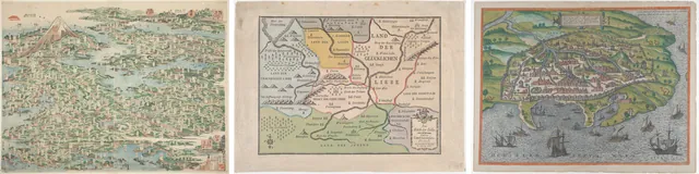
- The Famous Places on the Tokaido in One View (Tokaido meisho ichiran) (opens in a new tab) · Katsushika Hokusai 葛飾 北斎 (Japanese, 1760-1849) · 1818 · Color woodblock print; o-oban · Art Institute of Chicago · CC0A pictorial map of the Tōkaidō road crowded with tiny towns, rivers and bays in green and blue, with Mount Fuji and a red sun at the top left.
- Valentine: Map of the Kingdom of Love (Das Reich der Liebe) (opens in a new tab) · Breitkopf & Härtel (German) · 1777 · Printed on paper from type composition, hand-colored · The Metropolitan Museum of Art · CC0A hand-coloured allegorical map of a Kingdom of Love, with pastel regions, rivers, little mountains and German place names.
- Map of Alexandria (opens in a new tab) · Georg Braun (German, 1541–1622) · 1575 · Etching, hand colored · The Metropolitan Museum of Art · CC0A hand-coloured bird's-eye map of Alexandria, its walled city on a green coast with sailing ships on a blue sea.
- The City of New York: Longworth's Explanatory Map and Plan (opens in a new tab) · David Longworth (American, died 1821) · 1817 · Hand-colored engraving · The Metropolitan Museum of Art · CC0A coloured street map of lower Manhattan with ward boundaries, a street index at the side and small pictures of buildings along the top.
- The Map of the Globe, Terminal Page of the set of eight Pictures of Foreign Ships (opens in a new tab) · Unknown Artist (Japanese, date unknown) · 1840s–1850s · Color woodblock print · Art Institute of Chicago · CC0A Japanese world map of two hemispheres on a dark blue ground, with continents in red, yellow and green under a red title panel.
- Map of Greece, from "Speculum Romanae Magnificentiae" (opens in a new tab) · Sebastiano di Re (Italian, active Rome, 1557–63) · mid-16th century · Engraving · The Metropolitan Museum of Art · CC0An engraved map of Greece and the Aegean Sea crowded with islands and place names, with a decorative cartouche at the lower left.
- Plan of Ancient Rome, from "Speculum Romanae Magnificentiae" (opens in a new tab) · Pirro Ligorio (Italian, Naples ca. 1512/13–1583 Ferrara) · 16th century · Engraving · The Metropolitan Museum of Art · CC0An engraved plan of ancient Rome showing its monuments, walls and the winding Tiber, with Latin text panels.
- Map of Ancient Rome Illustrating Major Monuments and the Seven Hills (opens in a new tab) · Jan Goeree (Dutch, Middelburg 1670–1731 Amsterdam) · before 1704 · Brush and gray wash, pen and gray and brown ink over red and black chalk · The Metropolitan Museum of Art · CC0A pale drawn map of the hills and walls of ancient Rome beside a classical monument where a man sits reading.
- Plan of ancient Rome with a view of the Pantheon lower left and a triumphal arch lower right (opens in a new tab) · Carlo Nolli (Italian, Como 1724–after 1770 Naples) · 1748 · Etching, sixteen separate sheets joined and backed on linen · The Metropolitan Museum of Art · CC0An engraved plan of eighteenth-century Rome on joined sheets, with a decorative title cartouche, a compass rose and long index columns.
- Plan of Rome..., from "Le Antichità Romane" (Roman Antiquities) (opens in a new tab) · Giovanni Battista Piranesi (Italian, Mogliano Veneto 1720–1778 Rome) · ca. 1756 · Etching · The Metropolitan Museum of Art · CC0A plan of ancient Rome drawn as fragments of a broken marble map, with the word ROMA in large letters across the top.
- View of Venice (opens in a new tab) · Anonymous, Dutch, 17th century · mid-17th century · Etching · The Metropolitan Museum of Art · CC0A bird's-eye engraving of Venice floating in its lagoon, with mountains beyond, coats of arms at the top and Latin verses below.
- A Plan of the City of New York from an Actual Survey Made by James Lyne, 1728 (opens in a new tab) · James Lyne (American or British, active 1728–44) · 1834–72 · Lithograph · The Metropolitan Museum of Art · CC0A pale map of early New York at the tip of Manhattan, with streets, wharves, a large title and coats of arms.
- Bird's Eye View of New York and Brooklyn (opens in a new tab) · John Bachmann (American, born Switzerland, 1814/15–1896) · 1851 · Lithograph with tint stone · The Metropolitan Museum of Art · CC0A black and white bird's-eye view of New York and Brooklyn on either side of the East River, crowded with ships.
- The Inn Valley from the series Civitates Orbis Terrarum, vol. V, plate 59 (opens in a new tab) · Simon Novellanus (Netherlandish, 16th century) · 1590 · Etching · The Metropolitan Museum of Art · CC0An engraved view of the Inn Valley with steep alpine peaks above fields and villages, and two smaller valley scenes below.
- Bird's-Eye View of the Great New York and Brooklyn Bridge, and Grand Display of Fireworks on Opening Night...May 24, 1883 (opens in a new tab) · A. Major (New York, NY) · 1883 · Color lithograph · The Metropolitan Museum of Art · CC0A coloured bird's-eye view of the Brooklyn Bridge lit by fireworks over a night harbour full of sailing boats and steamers.
- Map of the World: Tradewinds (opens in a new tab) · Unknown Artist (English, 19th century) (published by Bernardi Sylvani (Italian, active 1511)) · 1511, reprinted 1889 · Woodcut in black on cream laid paper · Art Institute of Chicago · CC0A facsimile of an early world map on a heart-shaped projection, ringed by puffing wind heads, printed on cream paper.
- Map of the Mercator Projection (opens in a new tab) · Unknown Artist (English, 19th century) · 1595, reprinted 1889 · Engraving in black on cream laid paper · Art Institute of Chicago · CC0A facsimile of Mercator's map of the Arctic, a round map of the North Pole in a decorative square frame with corner roundels.
- Celestial Globe, Cover of the set of eight Pictures of Foreign Ships (opens in a new tab) · Unknown Artist (Japanese, date unknown) · 1840s–1850s · Color woodblock print · Art Institute of Chicago · CC0A Japanese print of an ornate celestial globe on a red stand, below a black title panel with large characters and red seals.
- View of Venice (opens in a new tab) · Jacopo de' Barbari (Italian, c. 1460/70–c. 1516) · 1500 · woodcut from six blocks on six sheets of paper · The Cleveland Museum of Art · CC0A woodcut bird's-eye view of part of Venice from high above, with the lagoon, distant mountains and wind heads in the clouds.
- View of Venice (opens in a new tab) · Jacopo de' Barbari (Italian, c. 1460/70–c. 1516) · 1500 · woodcut from six blocks on six sheets of paper · The Cleveland Museum of Art · CC0A woodcut bird's-eye view of the whole of Venice set in its lagoon, surrounded by ships, clouds and small islands.
- Nuova pianta di Roma data in luce da Giambattista Nolli l’anno MDCCXLVII, known as La Pianta Grande di Roma (opens in a new tab) · Giovanni Battista Nolli (Italian, 1701–1756) · 1748 · etching and engraving · The Cleveland Museum of Art · CC0A section of an engraved street plan of Rome showing a bend of the Tiber, city blocks and gardens in fine black lines.
- Nuova pianta di Roma data in luce da Giambattista Nolli l’anno MDCCXLVII, known as La Pianta Grande di Roma (opens in a new tab) · Giovanni Battista Nolli (Italian, 1701–1756) · 1748 · etching and engraving · The Cleveland Museum of Art · CC0A section of an engraved street plan of central Rome, densely packed with dark city blocks between pale streets and squares.
- A Bird's Eye View of Smithfield Market, Taken from the Bear & Ragged Staff (opens in a new tab) · Thomas Rowlandson (British, London 1757–1827 London) · January 1, 1811 · Hand-colored etching and aquatint · The Metropolitan Museum of Art · CC0A coloured view looking down on a busy London livestock market, with pens of sheep and cattle in a square ringed by houses.
- Augsburg, from "German Views" (opens in a new tab) · Wenceslaus Hollar (Bohemian, Prague 1607–1677 London) · 1665 · Etching, only state · The Metropolitan Museum of Art · CC0An etched view of the walled town of Augsburg across a river, with a tall church tower rising above the roofs.
Credits and review status
Every work is in the public domain under its museum's own CC0 release, resized for screens by Denframe. Each work's title, creator and museum also travel inside the file and show on its placard.
Publication approval: recorded.